According to the Merriam-Webster dictionary, a tor is a high craggy hill. So High Tor is a high high craggy hill.
 |
| Photographs never adequately capture the change in elevation. This trail is steep! |
 |
| Bob enjoys the forest. |
 |
| Lovely deep shades of mossy green. |
 |
| Down from the rim trail, we followed the gorge downstream. Bob is standing on the musical ledge. |
Don't miss Bob's fine rendition of...well...some tune.
Maybe you can figure out what tune it is.
 |
| Did I mention the rain? It was quite the soggy hike on the slickest surface known to man... wet mossy rocks. |
 |
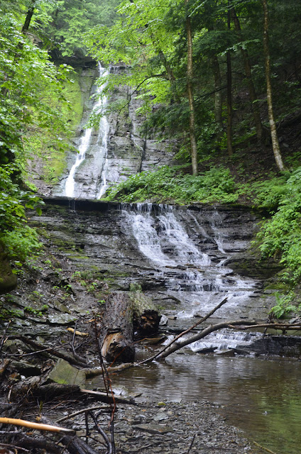
| This beautiful cascade appeared after we rounded a bend. |
 |
| Bob looks down from the top. How was the vantage point reached for this photo? |
 |
| Uuuuhh...Carefully!! |
 |
| Made it...without falling into the bathtub. |
 |
| This is the view down from the mid point. I decided to leave the descent for another day. |
 |
| The water drops about 30 feet to where I'm standing, and then another 30 feet behind me. |
 |
| One last look. So pretty. |
 |
| Here's a chunk of sculpted rock typical of many seen in the ravine. Bob thinks this may be fossilized wave action. |
 |
| Lots more fun and things to see as we headed back upstream. |
 |
| Bright shrooms on a gray day. |
 |
| Another nice cascade |
 |
| We headed past this point and farther upstream. You can just see the rope we used to help us up to the right of the falls. |
 |
| Easier going past another drop. |
 |
| The big falls is beyond this last obstacle. |
 |
| Bob ascends. |
 |
| Not only did we reach the falls...it stopped raining! |
 |
| It's about 18 to 21 meters high. For those of you conversion-challenged, think of 18 to 21 parking meters stacked atop each other. |
 |
| From the rim trail, you can look through the trees way down onto the bathtub. |
 |
| Looking toward the Canandaigua Lake valley from the south rim trail. |
 |
| Don't step back. |
 |
| A small cloud works its way up the gully. |
 |
| Bob brought his GPS device. He downloaded the data and got this plot showing route, elevation and speed. No records were broken...safety first! |


So beautiful, Great photos! Must have been an awesome day! Thanks for sharing.
ReplyDeleteYour Friend in San Diego,
Chris
Put it on your list for your next Upstate NY visit.
Delete